A place for every season.
NIBCO Water & Ice Park opened beside the Riverwalk, adding winter skating and warm-weather recreation.
City comprehensive plan, §6.5 ↗
Elkhart, Indiana
01 / THE RIVERWALK
Follow the shade. Find a favorite bench.
Explore the River Walk at York Woods
through the gallery below.
02 / BEYOND THE VIEW
Where the Elkhart and St. Joseph rivers meet,
riverside paths connect parks, public spaces
and a changing downtown.
Elkhart’s Riverwalk grew through a series of public-space projects: riverbank work, pedestrian connections, overlooks and places to gather.
Its design team describes engineering the path beneath the Elkhart Avenue bridge, stabilizing riverbanks and adding native plantings near the rivers’ confluence. JPR project history ↗
These describe different routes; they are not distances from York Woods.
Open the city’s interactive parks map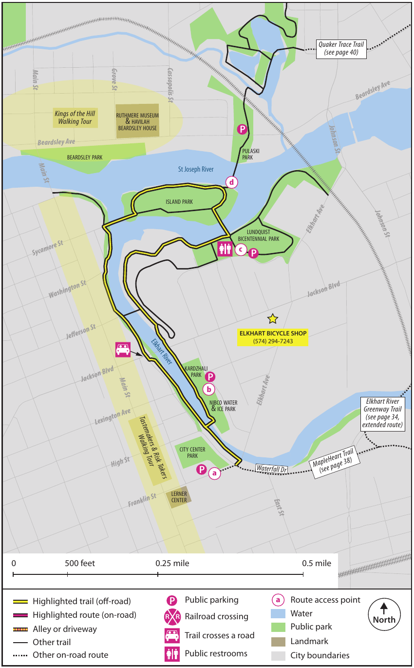
The county’s 2017 guide traces a 1.7-mile loop through downtown parks and over pedestrian bridges. This is a dated route map, not a live report of access or closures.
Source: Elkhart County walking guide, pp. 28–29 ↗03 / A RIVERFRONT, OVER TIME
A few documented milestones show how
Elkhart turned its river edges into places
for everyday life.
NIBCO Water & Ice Park opened beside the Riverwalk, adding winter skating and warm-weather recreation.
City comprehensive plan, §6.5 ↗A revitalization vision led to a city commitment of $30 million for public infrastructure and amenities. The 2018 plan linked the Riverwalk with civic spaces, housing and the aquatics center.
City implementation plan, p. 8 ↗JPR’s published project account describes the Town Green, riverside pavilion, river access and a 1.5-mile Cultural Trail connecting the River District.
JPR’s project account · November 2024 ↗